
|
Weather Maps |
Current Conditions |
Forecast |
Image Archive |
Data Archive |
|---|---|---|---|---|
|
NFDRS Fire Weather
|
US48 | AK US48 | AK US48 | AK US48 | AK US48 | AK US48 | AK |
US48 US48 US48 US48 US48 |
|
|
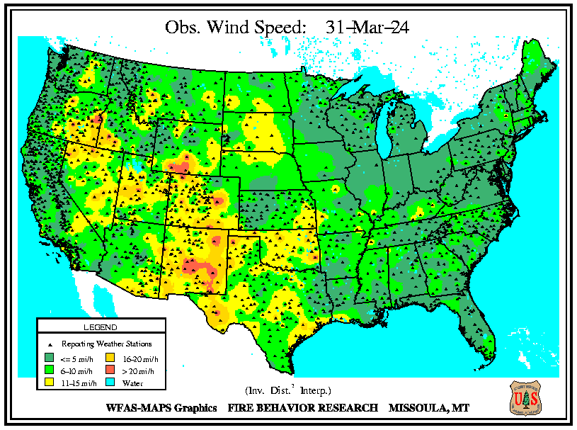
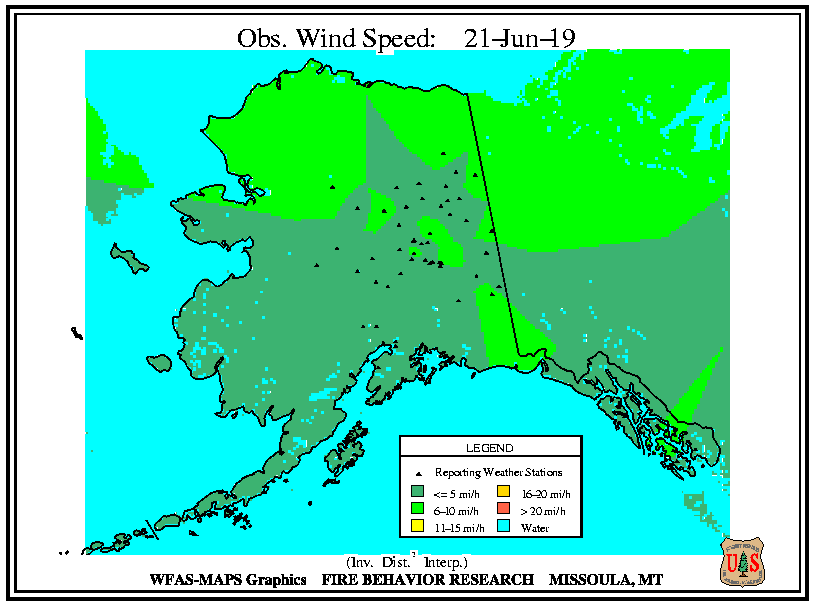
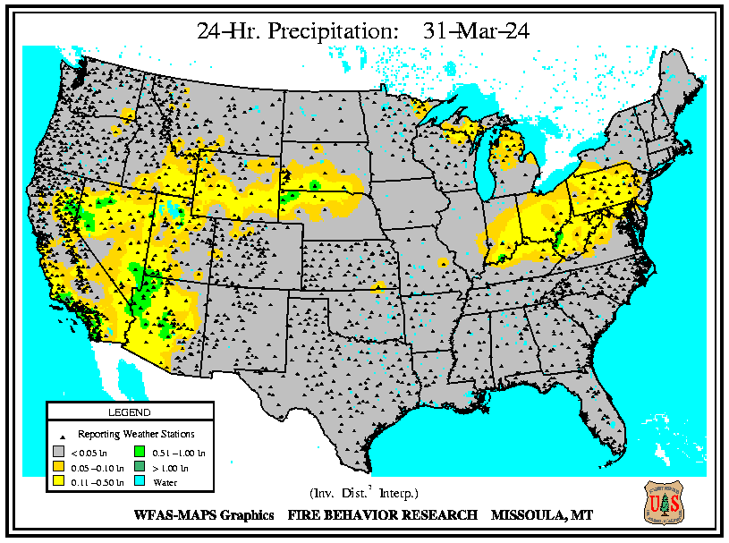
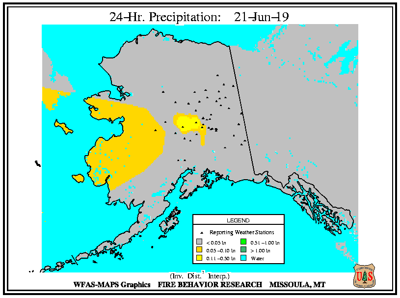
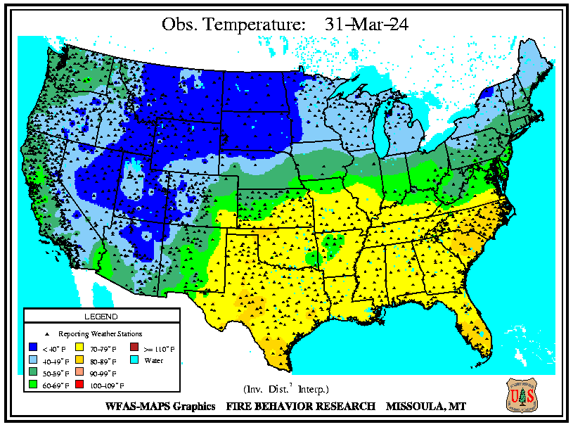
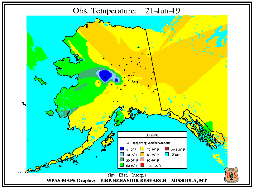
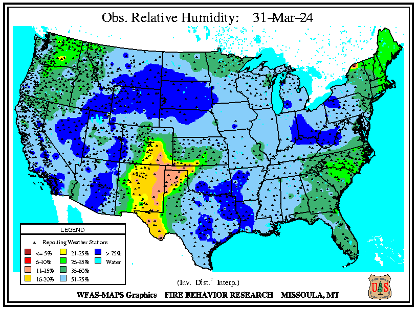
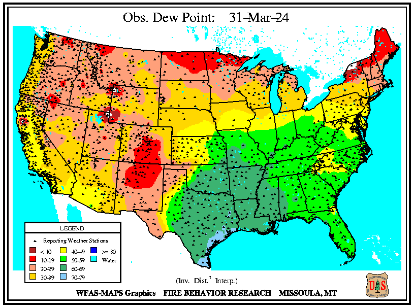
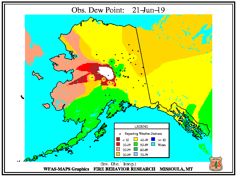
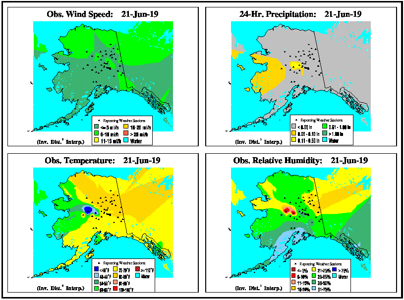
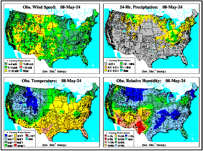
Observation maps are based on the mid-afternoon (2 pm LST) observations from the fire weather network as reported to the Weather Information Management System, WIMS (USDA 1995), by 5 pm Mountain Time.
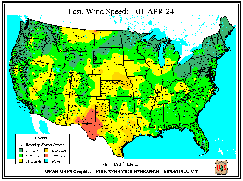
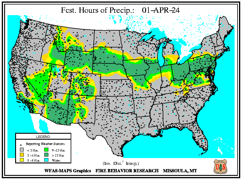
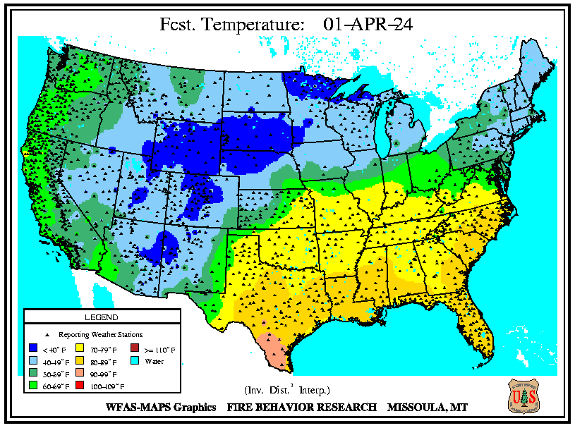
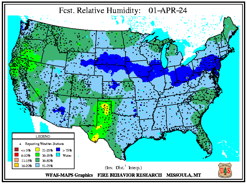
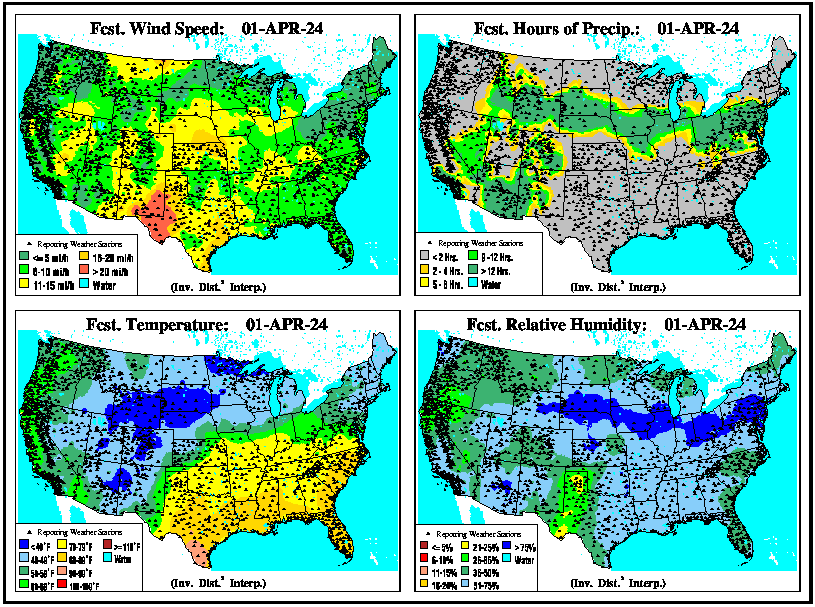
 Forecast maps are based on the afternoon fire-weather zone trend forecasts issued by National Weather Service Fire Weather Forecasters.
See Map Data for a tabular list of the data used to produce the maps.